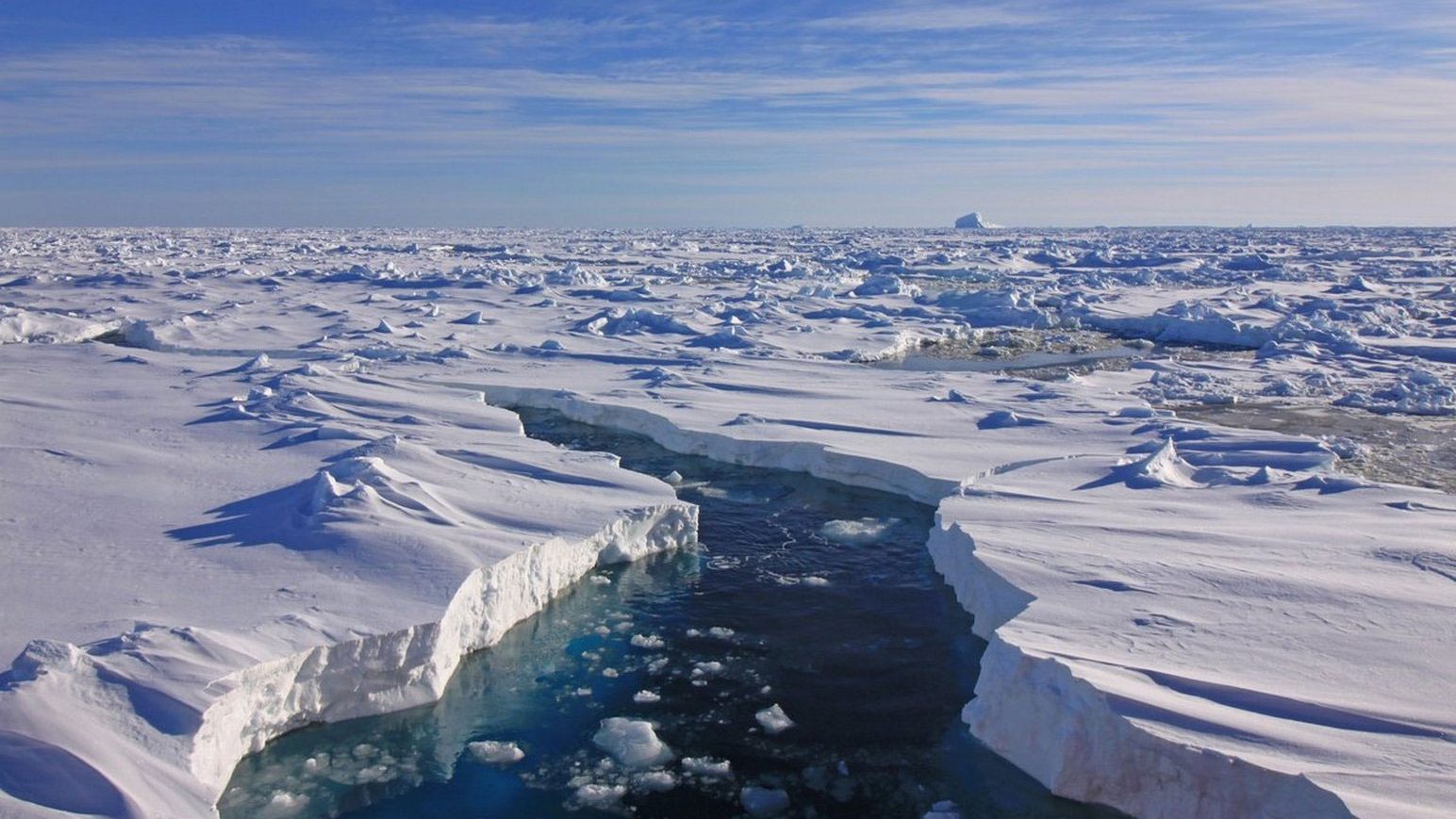
Jan 21/99 – In Ottawa I take George and Arlie Hobson out for dinner at a Greek restaurant. George informs me that Tom Gross “has located Supunger’s vault” on a trip to King William Island, but failed to investigate it thoroughly. Tom is planning a trip to the site in May. I decide to call Tom to get the details.
A few days after my return home I call Tom and learn that he actually saw the site in 1993 when on a summer excursion. He didn’t think it was significant at thetime, since he had not yet seen the Supunger testimony. After watching the documentary made after my 1994 trip, and hearing the description of the site in my briefing to the search team he “realized that he had already found what we were looking for!” According to him the site has features described by both Supunger and Bayne, and consists of two large flat stones placed together within a small circle of upright erratics. He assures me that the site will be easy for him to relocate. He also believes that the site is the last in a chain of cairns which starts on the east coast of King William Island, intended to lead overland searchers to Franklin’s grave. He is intending to go with his friend Louie Kamookak (Louie later backs out due to other commitments) by snowmobile and sled to the site in late May and I volunteer to accompany them. Because of extreme spring temperatures Tom later advances the date to May 11th as we must go before the snow melts.
May 10th – Franca leaves for work at 5:30, I drive the girls to school at 8:45 and fly to Yellowknife arriving at 9:35 pm. Stay at the Yellowknife Inn, $135 a night and worth every penny of $40. An uneventful trip, my only worry being the transport of my three pieces of luggage, none of which I can easily do without – all arrive safely.
Tuesday, May 11th – While boarding the shuttle bus at the Yellowknife Inn a lady knocks on the window and tries to attract my attention. I think she just wants me to open the van door for her so I do, only to have her say “Hi Dave, what are you doing here?” It’s Janet Leader from the ’94 expedition on her way to work. The shuttle is about to leave so I give her a very brief explanation, she has already heard about the trip through the grapevine. I promise to call her when I get back.
Also in the shuttle is a gentlemen who introduces himself as Rick Dyer, a friend of Tom’s and next-door neighbour of Louie Kamookak. We regale ourselves with Franklin search stories for the ride to the airport and wait for the flight. To my relief Tom arrives on his flight from Hay River, and we are set to go. Fly First Air to Gjoa Haven (3 hr flight) and arrive at 12:20.
Louie meets us at the airport and ferries our gear to his house. Tom needs Louie’s sled and was worried that Louie might not yet be in town as he had been out hunting caribou all weekend. They have had success (10 caribou – 7 by Louie and 3 by his young son) and as we arrive the sled in question is being unloaded of his gear and one carcass is being “processed” in a box in front of the house. There is still frozen blood on the sled from the animals, but Louie and I turn the plywood over to a clean side, Louie lines the box of the sled with caribou and musk-ox skins and we start to load our gear and 45 gals of fuel. Louie thinks that we are going a little overboard with the fuel, he thinks that 20 gals will get us to the north coast and back. Although Louie’s sled is a large one (22’) our somewhat impressive pile of gear goes a long way to filling it.
Behind Louie’s house Tom and I begin digging a large crate out of a 2’ snowbank. Inside is the snowmobile which Tom had barged up to Gjoa from Hay River last year. Although the machine is a 20 year old Yamaha 440, which Tom bought second hand, he assures me that it was little used by its last owner and is in good shape. His assurances lose a little of their lustre when he informs me that the machine is so old that he couldn’t find spare parts for it at any dealer, but luckily came across a spare clutch when he visited the dump at Fort Providence
After a quick run to the local Co-op for supplies Louie makes us coffee and we start swapping Franklin stories. Louie, who is the grandson of William Gibson, is intending to search for a Franklin wreck this summer using his 22’ boat. The wreck he is looking for is the one near Cape Crozier, he thinks it is near the Royal Geographical Society Islands. He also tells me of finds in Douglas Bay and elsewhere made by Inuit hunters, and informs me that the copper sheeting we found last year was recently used in a school presentation in the local school.
When I ask about polar bears where we are going he assures me that there are none, but does admit that there is a party of tourists up there right now with some guides hunting for them. A half hour later he sheepishly informs me that the guides have radioed in that the hunting party just killed a polar bear. The party is staying at the “Polar Bear Hut” on Cape Sidney on the northeast coast. The news spreads through Gjoa Haven immediately, hardly anything happens on this island that the locals aren’t aware of.
There is a steady stream of kids coming and going through the house. They aren’t here to see the strange “kodlunas” however, the center of attraction is a very tiny puppy, the only survivor of a litter of eight, delivered to one of Louie’s dogs yesterday. Louie offers to make us a meal of caribou tongue “the best part” but we don’t want to put him to any more trouble, and are anxious to take advantage of the glorious weather, clear with no wind. We take a few “before action” pictures, and at 5:55 we hitch up the sled, I climb in, and we’re off!
Within a mile I am wishing I had paid more attention to the gear when it was loaded. Bouncing around over the frozen drifts is like being in a small boat in a fairly rough sea, complete with the creaking wood noises of the sled and the gas fumes from the snowmobile. I have nothing to do but hang on and take the occasional GPS fix to track our progress. After a particularly vicious jab by the handle of my pot in the lower back I make a point at the first stop to rearrange all the bags to give myself a “soft” base. By the end of the trip I have perfected this into a science, although even at the best riding in the sled gives me the feeling of having been “shaken not stirred.” Tom does all the driving on the snowmobile which has a very unforgiving suspension. He consequently has it much worse, being even closer to the exhaust and engine noise.
We set a direct course for the south end of Collinson Inlet, about 70 miles away, and spend the night cruising through the center of the island at about 10 miles an hour. The night is glorious, cold and clear with not a breath of wind. The sun eventually descends to the horizon and turns into a large reddish-gold globe, but it doesn’t set in the land of the midnight sun but simply slides around the horizon. For most of the night it is directly in front of us. The snowmobile is just inhaling gas however, we are getting only about 5 miles to the gallon. Tom thinks that the sled is too heavy, the snow is also a little mushy. With stretch and hot-chocolate breaks we find ourselves just southeast of Collinson Inlet and getting weary by 3 am, so we decide to set up my small tent and get some sleep. After a quick meal of Mocha, Cup-o-Soup, Salami, and Pilot Biscuits we crawl in.
Wednesday, May 12th – Up at 9:30 after a good sleep. The weather continues fine, temperature at -6°C, and calm. The clear sky has been clouded over but the weather is still great for travelling. Our camp is at 69° 23’ 07”N, 97° 43’ 00”W. We have a quick breakfast of oatmeal and coffee then pack up and continue on our way.
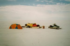
At 1 pm we stop northeast of Victory Point for lunch – Tea, Instant Noodles and Jerky. We have passed by Crozier’s Landing, and although Tom is anxious to continue on to his search area I convince him that it would be a shame not to visit the landing site which is only about a mile to the southwest. We decide to stretch our legs and walk to it but after a quarter mile we decide that trudging through the snow is a little more exertion than we want, and Tom returns to the snowmobile and unhitches it. He picks me up and we bounce to the cairn together – only now do I really realize how hard it is for Tom on the machine and how easy I have it as the “passenger” in the sled. We take some pictures at the cairn and I search around for about 20 minutes to see if the sea ice has exposed anything interesting on the beaches since my last visit, but there is too much snow. Tom is obviously impatient to go so we soon return to the sled. On the way we see the tracks of another snowmobile and sled, probably the “polar bear hunters.”
Tom is sure that he can drive “right to” the spot where he found the slabs in ’93 and his excitement builds as we approach the area to the east of Cape Maria Louisa. Unfortunately by 3 pm a thick fog has been blown ashore off the sea ice and visibility is reduced. According to Tom the main landmark we need is the hill marked “222” on the chart, the site lies between the sea and this hill. Rather than blunder around in the fog we stop and sit in the snow in the lee of the sled. I plot the position of 222 in my GPS, and after 40 minutes or so the visibility has opened to about half a mile. Although we still can’t see the hill we decide to navigate to it using my position.
Soon after we depart the fog blows away and we can see the hill, it definitely dominates the landscape here although it is not quite as dramatic in its snow-covered state as it is in the summer when there is more obvious relief. We sled up to the northwest side of the hill and then Tom sets a northwest course for the shore. We charge around and investigate every likely ridge in our path, but Tom is getting progressively more discouraged. I think we should ditch the sled and just search using the snowmobile, thus conserving our precious fuel, but Tom is always certain that the next ridge is our target. Eventually, near the junction of ridges to the northeast of Cape Maria Louisa, the sled gets truly stuck in a snowbank and rather than dig it out we decide that we have found our next campsite.
We set up the big tent and unpack our gear. This will be our center of operations for the next few days. At 7:30 we have a good supper of Irish stew, homemade buns, and blueberry cobbler. The clouds have blown away again and the night is clear but now windy (NW @ 10-15kts). It seems much colder now. We have already used 23 gals of the 45 gals of gas we set out with so we won’t be able to do much charging around on the snowmobile to find Tom’s site. I point out that we have plenty of time and we can conduct the searches on foot, doing 5 mile radius walks from our position. Tom remembers that he left a 5 gallon gas can in Wall Bay (just to the north of our position) in ’93, and decides to take the snowmobile tomorrow to see if it is still there. That would give us some freedom of movement.
We reread Supunger’s testimony to be clear what we are looking for. Tom and I review our own pet theories and debate the differences. At 10 pm we set up the radio and make contact with Louie. This will be our regular routine, and we have told him to come looking for us if he receives no contact for 7 days. We can hear him very clearly, but he can hear us “only a little bit – very weak.” At least he knows we are OK and where we are.
We are very tired and neglect our chores. Although the stove is out of fuel we don’t refill it, and we also don’t melt any snow to refill our 3 L of drinking water. Although we both know this is bad campcraft we are too lazy to budge from our nice cozy sleeping bags and tent. We will regret this in the morning.
Camp 2 is at 69° 46’ 41”N, 98° 10’ 26”W.
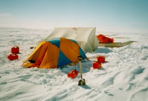
Thursday, May 13th – Wake at 3:30. Had a very bad sleep as the floor was not levelled very well and I was continually slipping down and to my right. The weather remains cold and clear, my breath has frozen around the opening of my sleeping bag and in my beard, our one half-full water bottle is mostly frozen solid as well. Pull our cold bones out of the bags and force frozen fingers to refill the stove with naphtha and start it up. This is why you do it at the end of the day when you’re still warm! Make a luxurious breakfast of Hot Chocolate, Mexican Omelette, Sausage, buns and tea. Lie around and talk, a little slow getting going this morning.
At 11 Tom leaves by snowmobile for Wall Bay. He wants to search all of the ridges to the north, and look for the 5 gals of gas he deposited. I stay behind and do some “housekeeping.” The big tent is nice for cooking and offers lots of room, but two bodies can’t heat it up, so I set up my small 2 man tent as well to serve as our “bedroom.” I also melt snow to replenish our water supply, repack and organize the food locker, and take advantage of the temporary privacy for a complete underwear change. Tom is back in an hour – no gas, no vault. He has found one site which is a “possible” but he doesn’t think it is the right one.
We are quite close to the position of the campsite that my party found on the coast in ‘95 (site Woodman #2). Here we discovered the remains of a possible nineteenth-century encampment with some tin cans. Tom theorizes that this might have been the shore camp of a party sent to bury Franklin in Supunger’s vault which he thinks is directly inland. He hopes that from the coast we might be able to see some landmark leading us to the Supunger site. We decide to walk to the shore and set out over the snow towards the sea ice. Although we have an exact GPS position which we walk to there are about 3 sites in sight which could be the correct one. I spent nearly two days here and have a very clear recollection of the site, yet even so everything is so snow-covered that I cannot be absolutely sure which pile of rocks marks the campsite. This is very discouraging to our hopes of finding Tom’s site, where he spent only a few minutes five years ago!
We trudge back to camp and arrive by about 2:45. It is very disheartening to realize that we have walked only about 4 miles round-trip, in three hours, and that we are totally exhausted. Granted that neither of us is as young or as fit as we should be, but the soft snow and constant stepping up and over drifts has taken it out of us. My earlier assertion that we could walk 10 miles a day in the search now seems foolish.
The afternoon is spent melting snow, eating (soup, jerky, trail mix) and telling stories. Tom goes on another short jaunt by snowmobile in the early evening, and returns after 20 minutes having eliminated another ridge. Supper consists of Kraft Dinner and leftover soup. Fill the stove and top up the water bottles, then into the little tent for a good night’s sleep.
Friday, 14th May – Wake at 7:30 to the same cloudy and cold conditions we had yesterday. Wind continues from the NW at about 10 kts. Breakfast of Mocha and oatmeal.
With the lack of gas there is no alternative but to search on foot, so by 10:30 we are out for a trip along the ridge extending to the south from our camp. Within 2 miles we find a very carefully-constructed cairn of a style I have never seen before. It consists of the typical flat limestone rocks laid in a circular pattern around a circular inner compartment about 6” in diameter, capped by one large slab. We remove the top stone and find the cairn full of snow, so we dig with our hands down to ground level but find nothing. The cairn’s location is 69° 45.819N, 98° 11.253W.
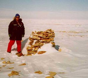
From this cairn we traverse a short distance to the southwest and check out a few more ridgetops, but the walking in soft snow is again taking it out of us. After a brief stop for a cold lunch of trail mix, jerky, and gatorade in the shelter of two knee-high rocks we decide that it is prudent to return to the tents for a rest. Shortly after heading north the wind brings another seaice-fog rolling in and visibility is again down to less than 1000 yards. We arrive back at camp, cold and tired, at 1:11 and begin the never-ending chore of replenishing our water supply with melted snow. We are very discouraged by the amount of snow and the seeming impossibility of finding Tom’s site. He is very downcast about this, and apologizes profusely for having dragged me here on a false promise, but I assure him that my main purpose was to see the island in winter conditions (such as experienced during the late April retreat by Franklin’s men in 1848) and that, although we are “uncomfortable” we have had no “suffering” yet. Tom superstitiously forbids me to use the “s” word!
Tom’s hopes now lie with his “cairn 1” on the northeast coast. Here he believes that some written directions were deposited for the direction of a recovery expedition which could have been expected to approach King William Island overland from the northeast. Although this cairn is on a well-travelled beach, he believes that from the old lichen on the stones it hasn’t been opened in quite some time, and hopes that some message might still be recovered. I am doubtful of this, but do believe that if we are to find Tom’s site we should follow his “line of cairns” to it rather than try and go directly to it from the side. We decide that to try and conserve gas we will travel only at night, when the snow is firmer.
We read/sleep until 8 pm and notice that the wind is getting stronger. Supper consists of soup and bread, and we start packing up our camp for tonight’s travel. Our 10 o’clock call to Louie is unsuccessful, too much traffic on all frequencies, so we decide to try again at 8 am. By 10:30 we are underway, the wind has again dropped and it is a lovely night. Tom has brought along a full suit of caribou clothing, and tonight he decides to wear the pants while I wear the parka. Although I haven’t been too cold in my modern fleece and goretex gear I must admit the caribou keeps me warmer as I sit in the sledge. It is too warm for any work however, and very restrctive as well.
Saturday, 15th May – We arrive at Tom’s “possible” site from Thursday, inland from Wall Bay. Tom is again not sure if this is the place, but we decide to dig a few test holes in the snow to see if they correspond with what he remembers. The snow is about 18” deep, and after three different excavations we decide that it is no use.
The rest of the night is spent in travelling up to Cape Felix and then down to Cape Sidney. We stop at each site of interest – the “western camp” described by Trafton, the CCG beacon on Cape Felix, and the PPCLI marker, taking photos at each place. At Cape Felix we find the remains of a recent camp and where a dog-team has been staked out on the snow. It seems that the polar bear hunters passed this way only a few days ago. At 2:00 we arrive at “cairn 1” which Tom carefully dismantles while I film. We find nothing there and rebuild the cairn. An hour later we arrive at the “Polar Bear hut” – pure luxury!
The hut is a simple plywood box, 16’ by 16’, with a door and one window. There are no furniture or utilities, but just to be able to get out of the wind is great. The hut was built in 1997 by the Hunter’s and Trapper’s Association (with gov’t funding). We move our stove and some supplies from the sledge (which is about 30 yards away) up into the hut, as well as our sleeping bags and some caribou skins to sleep on. Tom sets up the radio for the 8 am call, we can hear Louie but he apparently can’t hear us. Almost as soon as we arrive here the wind began to increase, it is now blowing about 20-25 kts and the cloud cover is so low that we have “white out” conditions. The packed drifts are so hard that there is very little blowing snow, but the sky is the same washed out white as the land so that there is no visual point of reference. We both congratulate ourselves on our planning to arrive at the only civilized shelter within 100 miles just in time for the first storm of the trip.
Breakfast consists of coffee and jerky. We lie abed and tell each other our life stories. Every hour or so one of us gets up for a call of nature or to check out the weather, the wind is going up and down and so is the visibility. We decide that there is no sense in blundering around in this weather, the possibility of finding anything is practically nil. We will therefore abandon the expedition and at the next calm interval proceed directly south to Gjoa Haven, which is 98 miles as the crow flies. We have only 17 gals of gas left in the cans, and another few in the snowmobile. At 5 miles per gallon this gives us just enough to scrape into Gjoa on fumes. If we get away tonight we might make the plane to Yellowknife tomorrow at 5.
Lunch consists of Oriental Sweet and Sour (from dehydrated), cookies, and coffee. Every time we fire up the stove it brings the temperature of the hut up a few degrees and fools our co-resident fly into thinking it is spring. He flies around until the hut cools down again, then returns to hibernation on the window sill. We are so bored that this seems to be the height of amusement to us.
The afternoon is spent in napping/reading and more story telling. We describe our jobs, and agree that even stuck in a small box in the arctic we are really in no hurry to return to them. The wind increases and conditions are getting worse – looks like another night here. We will miss the Sunday plane and shoot for Tuesday. I have two books and two magazines with me, I read the first book on the aircraft to Yellowknife and am now halfway through the second.
Our radio call to Louie at 10 is again problematic. We have excellent reception but poor transmission and don’t know if he is hearing us. We listen in to the other callers, most of whom are talking in Inuktitut. We don’t understand them but the sound of their conversations makes us feel less isolated.
Supper at 11:30 consists of fried spam, freeze-dried mashed potatoes, pilot biscuits, and cheese.
Sunday, 16th May – 10 hours sleep! Finally roll out at 11:30. The hut is cold, breath is steaming and water bottles frozen solid. The wind has shifted to WNW with blowing snow (20 kts). Visibility 1.5 miles, cloudy, -10°C (?)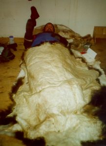
Can’t spend more than 10 minutes outside without freezing, maybe 1 minute without gloves. I’m wearing:
2 pairs of socks
insulated snow boots
underwear
2 pairs of longjohns (silk inner, polyprop outer)
heavy fleece pants
t-shirt
2 fleece tops (one light, one heavy)
balaclava, toque and fleece hood over my head
wool gloves
and when I go outside I add:
insulated vest
snow pants
Gore-Tex parka
elbow-high snow mitts
and I’m still chilly outside my sleeping bag!
Looks like another idle day. Spent ½ hour this afternoon turning the snowmobile into the wind, fuelling it, and putting a cover on it. We also dig out the sledge (which had drifted up a little). There are 10 45-gal fuel drums close by so we go check them out. Six of them contain “Turbo B” aircraft fuel, the other 4 contain Jetfuel. Tom thinks that the Turbo would work in the snowmobile, but doesn’t want to break into sealed drums. Even if we only “borrowed” a few gallons the rest would be suspect and unusable for aircraft once the seal is broken.
Only breaks in the boredom are by meals – lunch of instant noodles and pepperoni, teatime consists of oatmeal cookies and coffee. Tom and I hammer out Franklin theories, indulge in a little in absentia character assassination, read and nap and hope the wind dies down.
Call Louie at 10, same problem will try again at 07:30.
Supper is Beef Stroganoff and corn. I used up 2 batteries on my walkman today but managed to listen to all 4 of my tapes. Other highlight is a complete change of socks.
Last night I was a little chilly in the sleeping bag, it was made for a skinnier version of me with fewer clothes and won’t zip right up to the shoulder. This afternoon I went down to the sled to fetch the musk-ox skin from the box, I will use it as a supplementary blanket over my feet tonight. It is still fringed with ice so I can’t use it over the rest of me.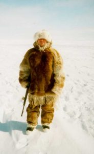
Monday, 17th May – 07:30 no contact with Louie. Wind has shifted to NNE and increased to a steady 20 kts with gusts to 25. Its constant moan is the only sound up here. Visibility is slightly better today and we consider leaving for Gjoa. Now shooting for the plane tomorrow but I worry that our lack of patience is starting to overcome our prudence. The weather, if anything, is getting worse.
11:00 – Breakfast consists of cheese/pepperoni/pilot biscuits and mocha. My book is done so I go through the magazines again reading the articles that I had no interest in the first time. Tom is enjoying my book about Shackleton’s Antarctic ordeal and we cannot complain too much when we discuss what they went through! I’ve finished reading my second book, which wasn’t very good, so am waiting for Tom to finish the Shackleton one so that I can read it again!
4:15 pm – Looks like the weather might break, so we begin packing up for a speedy departure. It is still just possible to get to Gjoa in time for tomorrow’s flight! We pack up the radio, shovel out the sledge and hope to leave at midnight. By six o’clock we actually have patches of blue sky. The weather is definitely changing, our only worry is that it will be short-lived and catch us out on the trail. I do a little outdoor filming – my battery finally dies.
Tom is starting to feel bad again about “missing” Supunger’s site. If we only had 5 gallons more gas! We discuss options, from getting more fuel at Gjoa and trying again to mixing in our remaining naphtha with the gas and reverting to my “emergency” propane stove for cooking.
By 6 pm the clouds roll in again, good bye blue sky! Tom goes out to check out each drum in the aircraft fuel cache. He returns shortly to say that one of the Turbo B drums is almost empty, perhaps 15 gallons left. Since it has already been opened we are less reluctant to drain off a little for our use. We improvise a funnel out of an empty 1L oil container, and fill two of our empty 5 gal cans. We now figure that we have enough fuel to retrace our route and get one more shot at the Supunger site on the west coast. We must still wait for the weather though – the wind is back.
At 10 we get through to Louie. Communications both ways are better now that we have installed new batteries in our set (Duh!) and he now knows our plans. He is going out sealing on Simpson Strait for the long weekend – hoping to leave Friday morning. Tell him we hope to be back in Gjoa by then.
Supper is Kraft Dinner, cheese, sausage and pilot biscuits. A very good dessert – “Apple Brown Betty” (freeze-dried). Rather than unpack our gear from the sledge we will “rough it” a little tonight. Since my sleeping bag is packed deep I will try the now-thawed musk-ox skin as my only covering tonight. It is fairly aromatic – but then so am I! Pat Benatar on the walkman and so off to sleep. The sky seems to be clearing again in the north and west.
Tuesday, 18th May – The weather is teasing us. Morning winds are the strongest yet from the north, overcast skies with 1 mile visibility and temperature even colder (-15°?). I get up at 06:30, it’s too cold under the musk-ox skin and I need to move around to get warm. I make myself coffee and oatmeal for breakfast, Tom sleeps in till 8. We try the radio to see if we can get a sense of the weather elsewhere, but it is no good. We discuss draining another 5 gallons of Turbo B to use in the stove as we are running short of naphtha.
Lunch is Cup-o-Soup and candy. I teach Tom how to play cribbage but take no mercy on him and beat him three straight games. Wind is coming from every direction today, and our pet fly no longer wants to wake up – we’re probably not getting the hut warm enough as we keep the stove on only briefly trying to conserve fuel.
Supper is lasagna. Good communications with Louie tonight, we tell him we might leave tomorrow. With the fluky weather I want to go directly to Gjoa Haven, Tom still wants to retrace our steps which is about 30 miles longer. I reluctantly agree. We’re impatient to get going now.
Wednesday, 19th May. – No morning communications with Louie. Wind has dropped to only 5 kts, but there is still 100% cloud cover and visibility is only 1 mile in whiteout. Tom thinks that if we keep close to the sea ice for reference we can work our way back along the coast to Cape Felix and then south. We have a quick breakfast of oatmeal and coffee and then pack up the sled again.
By 10:45 we are moving again, it feels so good! After only a half hour or so the sled stops unexpectedly and I crawl out to find out what is wrong. Tom disgustedly points ahead and what do I see but the shed! We have gone in a complete circle and wasted ¼ tank of gas. Tom can’t see any landmarks and says it is like driving inside of a milk bottle.
There is nothing to do but go back inside the shed and wait some more. We only take the barest gear out of the sled, hoping for another chance. The wind picks up and then drops off again. By 4 pm we face the fact that we’re not going anywhere today. We decide not to unpack the main stove but to try to use my propane one-burner. The supplied base is not compatible with the propane cylinder which was available at Gjoa so I spend the afternoon whittling away at it to make the bottle fit.
Evening radio reveals that the weather is clearing at Montreal Island (about 150 miles south of us). We are still undecided about the route back, we go around again on the direct vs. indirect (searching) route. We still have not used the Turbo B and I am afraid that if it doesn’t burn well and we take the longer route we will be in trouble. If we go direct we will still need it, but if we save it till last and it doesn’t work well we will be within walking range of Gjoa. At least it will be a shorter distance for Louie to come to bring us more gas or collect us. Tom still unwilling to give up the search, he is more confident in the Turbo B, and thinks I am too pessimistic.
Radio call at 10 – Louie says the long-range forecast is for 2 more days of cloudy weather. Outside the wind has died off and the cloud cover seems lighter, so we are still hopeful that we might get away. Have a cold supper of cheese, jerky, and biscuits. At 10:30 we decide to try again and depart Cape Sidney. Good bye “Polar Bear Hotel” and thank you. As the miles pile up toward C. Felix, then southbound we are committed to a run to Gjoa. Near Cape Maria Louisa we unhitch the sled at two locations and Tom takes short excursions on the snowmobile to check out likely ridges. One of these turns out to be the one where we excavated the three holes, nothing found at the other.
The snow is very heavy here, and the sled gets stuck repeatedly. On these occasions I get out and push, then run alongside when the sled gets moving well and jump on. Only once have I missed the jump and ended up on my face in the snow! On one occasion we get stuck three times within 100 yards, the last time so badly that we think we will have to unpack the whole sled to lighten it. We give it one more college try however and get it into firmer snow.
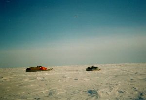
Once we reach the sea-ice in Collinson Inlet we begin to fly. We are now making good almost 20 miles an hour – twice the speed we have done up to now. If this keeps up our gas problems will be solved. Once we leave the coast we will have to navigate by GPS, with me tracking our position and Tom looking back every few minutes for an indication of our course. I set up the GPS as we approach the southern end of Collinson Inlet and then notice that Tom has followed the coast right around until we are again travelling northwest! I start to scream at him but he can’t hear me over the wind and engine noise, so it takes almost 20 minutes to get his attention. We have gone almost three miles away from Gjoa again and I am hoarse for the next two days. We are mixing the Turbo B with the regular gas, at first 1:4, then 1:2 and it seems to burn well so fuel is probably ok now.
Retracing our route over the middle of the island is long and cold, but the snow is firm and we make good time. We take only one short break to make some warming hot chocolate. The weather is the best it has been since the first two days. The tower at the Gjoa airport rises above the horizon at 10 miles, and takes forever to get closer, but eventually we are there. We arrive at Gjoa at 9:45 after travelling for eleven and a quarter hours – cold and stiff and too tired to get the sledge up the hill to Louie’s. We stand around for a few minutes and then Louie magically arrives with the pickup and tows us up to the house. The morning is spent with coffee, showers, and stories. We repack our gear for the aircraft and get into our “civilized” clothes. Louie’s wife Josephine kindly makes us a traditional Inuit lunch of chicken soup and pizza. Tom and Louie are already making plans to do a search for Supunger’s site in August by all-terrain vehicle, while I discuss next year’s wreck search with Louie and talk about using his boat.
Before we know it it is 3 pm and time to get out to the airport. At 4 we depart for Yellowknife, and arrive at 7. Tom and I call home to warn our wives of our early return, and then proceed to the bar for a beer and Kentucky Fried Chicken for some much needed greasy food. The expedition ends.
GPS Positions from 1999 trip
| Designator | Latitude | Longitude | Comment |
|---|---|---|---|
| Camp 2 | 69°46’43” | 98°10’20” | |
| Camp 3 | 69°44’00” | 98°07’00” | |
| Sidney | 69°50’42” | 97°39’17” | |
| Site 1 | 69°51’58” | 97°39’17” | |
| Cairn 1 | 69°53’05” | 97°58’58” | |
| AA | 69°46’48” | 98°12’48” | |
| Check 1 | 69°47’30” | 98°10’27” | |
| Check 2 | 69°44’42” | 98°14’18” |
